Thursday, December 31, 2009

The Lakes in the snow

After completing my SML assessment last month, I was on a bit of a high and felt inspired to get out into the hills more this winter. Steve Spalding had suggested that I head down to the Lake District to do some winter walking. Keen to take his advice, we headed down to Keswick on 29th December for a couple of nights. I knew there had been a large dump of snow in the last week so I was pretty psyched to get up a proper mountain in the snow. Unfortunately the weather wasn't very favourable and we spent most of our time wandering around the streets of Keswick. The best of the weather came on our last day but it was rather blustery. As we were meant to be driving back to Edinburgh later that night and because the weather wasn't perfect, I didn't want to attempt anything too serious. After all, I didn't have much experience when it came to winter walking... but I wanted more.
I suggested that we have a go at getting up the Saddleback (Blencathra). Emily quite fancied getting out into the snow but said that she wasn't up for anything too serious and neither was I, as I knew I had to drive back to Edinburgh later. So Blencathra seemed like the sensible choice.
Enjoying the cold at Gategill, Blencathra behind
We were packed and on our way just after 10 am and it was a short drive from our B&B to the Threlkeld turnoff. We parked near the farm at Gategill and got out to gear up. It was cold. I could feel my ears hurting as I packed our bags. We slipped our way along the minor road up to the farm and up the track through the woods. The going was slow and it was a bit of a slog as the snow got deeper. It was soft and powdery and icy underneath the fresh layer (about 10 inches deep). Now out of the trees, we headed up the steep slopes of Hall's Fell - the snow got deeper. We had crampons in our bags but the snow was deep rather than icy, so I didn't think they would improve things. The summit was covered in cloud from about 500 metres. Emily was doing really well and we pushed on through the snow. When we reached around 550 metres, the wind really picked up from the East. It was constant and bitterly cold. We did up our jackets as high as we could and tried to shield our faces from the wind. The wind got stronger as we climbed slowly higher. It was so strong now that it was difficult to walk and stay upright - relentless wind. I knew it was no good and I knew Emily wouldn't stand it for much longer so we turned back and headed down the hill.
Looking up to Hall's Fell from Doddick Fell, Blencathra
When we reached the bottom, I suggested that we head further East towards Doddick Fell and see what it was like. After following the traverse path to the East above Doddick, we turned up the steep slope and into deeper snow once again. However, it wasn't long before we were in the same situation; getting battered by the freezing wind. It was no good, we were fighting a loosing battle. We headed back down in defeat - cold and battered. Emily made numerous snow angels on the way down, making the most of the deep powder.
Heading up Doddick Fell, Blencathra
Looking up to Blencathra summit between Hall's Fell and Doddick Fell
We took a bit of a battering but it was a good experience and gave us a taste for what full in winter conditions can be like. We were in good spirits as we headed back to Edinburgh with pink faces...
Emily enjoying the snow, Doddick Fell

Saturday, November 7, 2009

Summer Mountain Leader Assessment - Day 6

It was a good nights sleep and I was glad to get a good rest after the long day yesterday and the day before. We packed up quickly and were ready to leave just before 9:30am. We had a short walk down the hill to Kilfinnan. We were all much more relaxed and we had some banter as we strolled along in the fine morning air. As we descended, we spotted Richard's car down at the farm where he was waiting to pick us up.
A few hundred metres from the car, Steve turned to us and told us that it had been a pleasure and that we had all done very well. He sent the others on ahead and turned to me to say that we were going to have a bit of a chat. I had a pretty good idea about what he was about to say; I immediately thought of my logbook. Steve said that he and Richard had noticed that my logbook was a little 'light'. I suddenly felt a thick lump in my throat. Last week I had made sure that my logbook was up to date and it had details of absolutely everything related that I had ever done. However, when I looked over what a quality mountain day was, I knew that a few of the entries just didn't cut it. But I wanted to give the assessment a go anyway and if I failed then so be it. Steve was very nice about it and he asked me if there were any more quality mountain days that I hadn't entered in my log. I said that I didn't think so. He reminded me that, during the SML training, he had stressed the importance of lots of experience and a more than adequate log book. We joined the others and Richard greeted us warmly. I was a little deflated after that chat but I was glad it was over and I was pleased with how I had performed. Now all I could do was wait for the verdict; but I wasn't holding my breath.
Richard was in good spirits; he chatted away to us as he drove us back to Calluna. He wanted to hear all about our expedition and I got the impression that he was a bit gutted not to have gone with us. He dropped us off and asked us to meet him and Steve at a cafe in Fort William in an hour. We were glad of the hot shower and a brew. After packing up our gear we had a quick chat and a brew. James was pleased with how it had gone and we agreed that the whole week had been like a 24hr constant driving test; mentally draining and with no feedback... for 5 days straight. Certainly not something we would forget in a hurry. I told James what Steve had talked to me about on the way off the hill this morning. I told him that I reckoned I had done pretty well throughout the week but I didn't think I would pass on my logbook. All of a sudden James started worrying about his logbook and whether he had enough days too. This made me chuckle to myself, as I knew how experienced James was. I was relieved it was over and my real concern was that I hadn't done enough and I would have to come back and do the whole week again.
We loaded up James' car and headed into the centre to meet the others. Everyone was already there; Steve and Richard were sitting at a table at the front of the cafe and they directed us to sit at a table at the back with Darren and Mike while they talked things over. James and I were straight in with the order of coffee, orange juice and bacon rolls; definitely feeling the need to rehydrate and replenish our broken bodies. We were called up individually to be debriefed by Steve and Richard. Darren went first and wasn't away very long; he came back grinning and said that he was really pleased with the positive comments he had been given. I was pleased for him, as he seemed like a really good guy and it was a pleasure to be on the same assessment as him - great company. James also came back beaming, as I expected - I knew he had done really well, despite his own concerns. Mike was gone for quite some time and I took the opportunity to order another coffee. Mike came back looking rather sheepish but said that he had passed. I was up last. I grabbed my coffee mug and sat down opposite Richard and Steve.
Richard kicked things off by going through my logbook and, taking each entry in turn, explained if it qualified as a quality mountain day or not. He said that my experience was really quite weak but he had been quite generous in counting 17 of the entries as quality mountain days. Richard said that I seemed to lack a bit of confidence managing the group on steep ground and I told him that I agreed. Steve then went through the expedition and said that he could tell that I was quite nervous - I said that I had been very nervous throughout the week - but he thought it was a bit more than that. He thought that I had lacked some decisiveness in my decision making and route finding. He knew that this was down to my lack of experience. They told me that due to my lack of experience and the fact that I had only done the training a few months ago that I would usually have to come back and repeat the entire week of assessment. I suddenly felt nauseous and my heart started to sink, but then everything became a torrent of praise and positives. I was told that what I had achieved this week was "amazing" and that my navigation and rope work was excellent. Richard said that if I had the required logged experience, then I would probably have a pass! Instead, they had deferred me and they were going to make come back for a single day of reassessment with a small group on steep ground. I was told not to take this as a kick in the teeth and not to be disappointed as they had been very impressed with my technical skills on the hill. They told me that I would be a great leader in the hills with a little more experience.
I was overwhelmed with their positive comments and kind words and I agreed with everything they said. I told them that I had a feeling that I wasn't quite ready for the assessment coming into this week - I thought my logbook and experience was a little lacking. But I also told them that I knew I had the technical skills and was comfortable with my navigation and rope work - but I wanted to give it my best and now I was happy with the outcome. I told Steve and Richard that I had the utmost respect for them and that their comments meant the world to me and I would take their advice onboard about what to do next. Steve said that I needed to go and get 'lost' in the bigger hills on my own and have some adventures. He knew that I did a lot with GWC and that was great but I needed to have more solo epics and expeditions. He recommended that I should go down to the Lake District over the Christmas period and do some walking in easy winter conditions. Richard said that I shouldn't come back for reassessment for at least 12 months, that the deferral was valid for 5 years and I needed at least 20 more quality mountain days. I felt like hugging both of them but instead we shock hands warmly and I thanked them for a great week. The others came over and we all shook hands and went our separate ways.
As James and I headed back to Edinburgh, we were absolutely over the moon and buzzing with the outcome. Looking back I really couldn't have imagined just how well the week had gone - I really didn't think I could have pulled it off. My advice to anyone would be: don't put in for your assessment until you're more than ready for it. It's one of the hardest things I have ever done; like a constant driving test for 5 days with no feedback - a large amount of mental pressure. I'm glad to have done it and it's a great feeling knowing that I'll never have to complete the full week again.
A fantastic outcome.

Friday, November 6, 2009

Summer Mountain Leader Assessment - Day 5

We started walking again just after 9:30am and I was glad of the long lie, as I was quite stiff from the yesterday. Steve told me that it was my task to make a plan for getting us across the river and up to the top of Meall Odhar. The Abhainn Chai-aig was right in front of us and was wide, deep and rather fast-flowing. I also saw that there was a huge deer fence on the other side that we would also have to negotiate. There was no other option but to head upstream and look for a place to cross. We followed the river for what seemed like an eternity until we found a suitable narrowing through some boulders and a steep bank on the other side. Once safely across I headed downstream towards a gate that I had spotted almost directly opposite last night's campsite. On reaching the gate we found it padlocked; there was no option but to climb it. Once over safely, I started heading steadily up and around the West slopes that lead to the top of Meall Odhar.
It was another cracking day - a good few degrees warmer than yesterday. At first, the steep slopes were covering in heather so our progress was quite slow. But as we climbed to around 600 metres, the heather ceased and there was only bright scorched grass in front of us. We were soon at the top and admiring the view North into Coire Odhar Mor. Our route continued on to Meall na Teanga; each taking it in turns to lead. We had some amazing views over Coire Odhar Beag on such a clear day.
We started the descent down to the bealach between Meall Dubh and the South slopes of Sron a' Choire Ghairbh. On reaching the bealach, Steve suggested that we take a rest for around an hour and a half and take some time to chill out; maybe have some food. We all got a brew going while we hung out our tents and sleeping bags to air and dry a little. We had an amazing view of the sun going down through Gleann Cia-aig. As the sun disappeared, Steve said that we were to push on.
After packing up, we headed off again with Mike leading the way up the zigzags. It seemed to get dark very quickly and as I looked around I realised that it was a combination of the sun going down and the thick cloud that was surrounding us. Mike was too busy chatting and had a bit of a faff taking us to the col above the end of the path in the thick mist. With our head torches now on I took us to the summit of Sron a' Choire Ghairbh. We didn't hang around here; James then set off heading along the Eastern spur, retracing our steps at first and then continuing on to bealach between Sean Mheall. The mist was now very thick and the rain had also started. This meant that I had to rely heavily on my pacing - I had to concentrate hard. After the bealach, Darren tried to find the small lochan that was on the plateaux just to the West of the summit of Sean Mheall, but all that we could find was bog where it should have been. We then pressed on to the top and took a breather, as Steve planned my next mission.
Steve came over and asked me to take us to the other small lochan that was slightly less than a kilometre directly East of the summit. I took a moment to study the map and I told him that the only way I had a chance of finding it was to take a bearing directly to it. He nodded in agreement so I took a bearing and set off down the steep slope. What I found, soon after leaving the summit cairn, was that we were now entering a large boulder field that seemed to be quite gnarly. It meant that the going was slow, as I had to look at my compass and choose a fixed point that I could see in front of me that was in line with the bearing, navigate around the boulders and arrive at the fixed point, then repeat the process. This was slow but made sure that I didn't deviate from the original bearing. The boulder field ended and the ground turned into peat hag with many ups and downs, but I could see that the overall lie of the land was much flatter; I knew we were getting close. I came across a large section of peat bog that was more or less where I expected the lochan to be but I wasn't certain. Was this it? Was I even still on the right bearing? The only thing I knew was that I hadn't gone too far and overshot the lochan yet so I pushed on through the bog and up the steep bank on the other side. As I went up over the small mound, I could see the water rippling in the moonlight - we were there!
The others led a few short legs to the ring contours to the Northeast of the lochan before Steve said that we would head North down the slope towards the Allt a' Choire Ghlais. On reaching the river we followed it East down to the trees around the Kilfinnan Fall. Here, we set up camp under some trees. Steve left us and headed to his tent after telling us that we didn't have to leave until 9:30am tomorrow morning. I thought this was great news because it was now after 2am and I really wanted to get my head down. I chatted with James a little as we had a brew and cooked some food but I soon started to shiver and I knew I was tired, so I headed for bed; too tired to even reflect on the day that had just passed.

Thursday, November 5, 2009

Summer Mountain Leader Assessment - Day 4

I was awake early and so was James. We had a good breakfast and laughed about how heavy each others rucksacks were - we were much more relaxed; as we knew the worst had to be over. We were actually looking forward to the expedition over the next few days and were keen at the opportunity to bag a few more hills in the process.
Richard and Steve arrived shortly after 9am and Darren and Mike followed closely behind. James and I loaded our gear into Richard's car, while Darren and Mike went with Steve. We headed out of Fort William and towards Spean Bridge. There, we turned off and headed to Gairlochy. Richard seemed far more relaxed and was very chatty in the car with James and I - this really helped us relax even more; it was a good feeling. We took the road around the North side of Loch Lochy to Clunes and stopped a bit further West at the farm at Achnasaul. We said goodbye to Richard (knowing we would see him in a few days at the end) and Steve gave us our briefing. We were told that the format would be much the same as our micro nav day; someone would lead a leg and the others would follow but not know the destination, and would have to show him where we where on the map, individually. James was given the first mission and we set off, following him North up the track towards the hills.
It was a fine day; bright and sunny with only a slight chill in the air. The blue skies made a very welcomed change from the torrential rain of the previous few days. The ground was very wet underfoot but we made good progress on the track. Looking at my map I could see that we had turned off the main track and were now heading East following the Allt Achadh nan Sabhal. We were chatting away as we made our way further upstream and Steve commented that we should still try to concentrate on where we were, despite the bright sunny weather. James stopped at a fork in the river to check his map and while we were patiently waiting, Steve asked us where we were. I pointed to the fork on the map and I was confident I was bang on, but Steve was pokerfaced as usual. I suddenly realised that this wasn't going to just be a pleasant walk in the hills after all - this was the real thing. James was still looking at his map and looking worried. He pointed to the map and Steve just chucked and said that we were actually somewhere else. James was disappointed and flustered but Steve did a very good job of reassuring him and getting him back focused again. Steve told him to get us back on course and James bounded off over the river, this time heading North back towards the main track. Steve turned to the rest of us and said, "Don't be fooled by the sunshine!" as he chuckled. I was now very nervous - this was the first mistake I had know James to make... ever! I was going to have to stay on my toes.
James lead us to the end of the track at the source of the Allt Dubh between Glas Bheinn and Beinn Mheadhoin. He was still apologising and everyone felt for him. Darren then took us West up a gentle slope to the bealach between Beinn Mheadhoin and Geal Charn. Then I lead us to the shoulder Southeast shoulder of Geal Charn and then Steve just said, "Let's go to the top". Here, we paused and had some food and some warm tea. The air was getting chilly, as the sun was almost down but there was not a breath of wind.
Mike then led us down the steep slopes to the East to Bealach Carn na h-Urchaire and stood next to the small lochan. My turn again and I headed up to the shoulder of Meall Coire nan Saobhaidh to the summit. It was now quite dark and we all took the opportunity to strap on our head torches before we continued any further. Our route then took us down to Bealach Choire a' Ghuirein, back up to Meall na h-Eilde and then down again to Bealach an Easain. It wasn't too difficult to follow where we were, as the route was pretty straightforward and the conditions were good - it was a perfect night. Steve then said to us that he wanted us each to plan a way down to Fedden (ruin) from where we where. I told him that it looked better to descend down to the North of the bealach, as the slope was less steep. The others had the same idea but Steve laughed and said that he agreed but there were no features on the map for us to find so he said we would head down the steeper South slopes. After a few more shorter nav legs each, we were almost down at the river. Steve asked Darren to find a campsite and he chose a great spot down by the river at an obvious dog leg (or kink) at NN194932.
After putting our tents up and having a brew, Steve came over to talk to James and I about how the day had gone. Steve was in great spirits and seemed quite relaxed. He gave us great encouragement and made us feel at ease - something he has a real knack for. We were told that we had done really well today and that we had been spot on with our nav on every leg. This was really good to hear and it was great to finally get some feedback.
Before bed, James and I confirmed with each other about where we had been and what the precise points on the map we had been asked to find. We both agreed on every one. Both knackered, we slept well.

Wednesday, November 4, 2009

Summer Mountain Leader Assessment - Day 3

When I woke, my first thought was that the rain hadn't stopped all night. My second, was that I remembered we were meant to be doing a river crossing today - brilliant.
We put on our old clothes, old boots and old waterproofs and waited nervously whilst sipping a brew. We could still hear the rain hammering down against the flat, as we flicked through the pages of Classic Rock. Richard soon arrived with Darren and Mike and they all came in and sat down. Richard said that we would go through the home papers first and hopefully the weather would clear up a bit, so I got up and put on another brew. We sat around and went through the home papers and discussed the answers together. It was clear that we all had good knowledge of the outdoors, the laws, regulations and best practice. The rain hadn't eased at all but Richard was still keen to cross a river so we jumped into his car and headed along the minor road towards Blarmachfoldach once again.
We parked at the roadside just above the river to our right. Down at the riverbank, Richard gave us a quick briefing. We were standing at a corner of the river and to our right the river looked deep and fast-flowing. To our left the river was wider, slower, more shallow and a lot more inviting. We were asked to get ourselves across safely using whatever method we liked. We all grabbed our walking poles and set off to the other side. The water was rather chilly to say the least and was fast flowing but only shin-deep and none of us had any problems getting across to the other side. Richard then asked us to move down the bank a little where the river was a little deeper and faster. We then each took it in turns to be in charge and get us all safely to the other side; this involved either the wedge or the single file technique. Then Richard got the rope out and it was time to get serious... and very wet. Richard took us  around the corner of the river where it looked deep and fast. We were asked to try out the 'V' technique with the rope and try to get us all across. James sat down behind a large rock on the bank that looked like a good belay spot. Darren went in first, holding onto the rope and doing his best to fight the strong current. He was making steady progress until he got closer to the other bank; where the river seemed to get deeper. As I looked on, Darren was really struggling and I could see that the water was rushing over his thighs and around his waist. I turned around and saw Richard had moved downstream and was on standby with a throw line. Darren made a lunge for the other side and rolled onto the high grassy bank. I was up next.
The rope came back over and in I went. Up to halfway the going was good, but then the water got deeper, stronger and faster. Wobbling a little I pressed on; using the tension of the rope for balance. To make things worse: the rocks underfoot became large boulders and they were smooth, slippery and hard to avoid. The water was now at the height of my waist and the water was gushing up into my chest. I couldn't keep my balance or fight the force of the current for much longer so I made a sideways lunge for the bank. I grabbed a handful of grass, swung my leg up and rolled onto the grass - I had made it... just! James came over next and he struggled to the other side the same as I did. Maybe I was just being a bit soft, but as James rolled up onto the bank he looked at me and I could tell he was thinking the same thing; that was a close call and I knew he had been right on the edge too. Mike then came over last with Darren belaying him. At around halfway, Mike became quite unsteady and as he went deeper, even more so. We all looked on but could do nothing; he lost his footing in the deep water. He tried to hold onto the rope and right himself but he couldn't as the current was too strong and was keeping his feet from under him. He was fighting a loosing battle and soon he had let go of the rope and was heading downstream. Richard had been watching and had thrown his line in for Mike to grab. Richard hauled Mike towards him and out of the deeper water until he could stand again and he stumbled to the other side. Richard shouted across to us and said that we were going to head back.
Mike was obviously soaked but he probably wasn't much wetter than then rest of us; the rain was still hammering down and hadn't stopped. I couldn't feel my hands as we crossed back to the other side, further up the river this time. As we headed back to Calluna to have hot showers and get warm again, I reflected on what just happened. Speaking to a few folk about their SML assessment, all of them told me that they never even did a river crossing on their assessment; their assessors talked it over with them and suggested that you would never attempt crossing a big river with a group. Clearly this assessment was of a much higher standard and that river crossing was certainly an experience!
After we were warm and dry again back in the flat, we sat around with a brew and laughed about what had just happened. After lunch, Steve Spalding arrived from Pitlochry. Steve was going to take over from Richard as our assessor for our expedition over the next 3 days. As usual, he was in fine spirits and we chatted about what each of us wanted to do for the expedition. James and I said that we weren't too bothered, while Darren and Mike fancied heading into the Mamores. Steve said that he had been looking at the weather closely over the last few days and he was concerned about the snow line and said that we had to try and stay below it. For this reason, he wanted to head to the West and fancied heading into the Glengarry Forest. Everyone seemed happy with that idea so it was settled.
After the others left, James and I couldn't wait to talk about the epic river crossing earlier and how we hadn't expected that at all. Apart from the experience being a little 'out there', we were both pleased with how the day had gone and felt we had coped well with all that was asked of us. We were well organised with our gear and supplies so it didn't take us long to pack our larger expedition rucksacks. Then we both fell into bed totally wiped from the last few days of activity and relentless concentration.
I was very much looking forward to the expedition.

Tuesday, November 3, 2009

Summer Mountain Leader Assessment - Day 2

After breakfast, we were surprised that all are gear had dried overnight in Calluna's excellent drying room. Richard was bang on time and we were soon all squeezed into his car heading out of Fort William towards Glen Coe. It was still raining and it was quite a chilly morning; certainly a good few degrees colder than the previous day. Richard told us that he expected snow on Ben Nevis today so he was excited at the possibility of some winter climbing later in the week. I had heard from some friends that Richard was quite a serious winter climber but I didn't really know what that meant. I always thought winter climbing looked pretty 'serious' at any time or level but would love to have a go - something else for the list. We passed through Glencoe village and parked at the large car park near Achnambeithach. We got out of the car to faff with our gear and get ready to go. I picked up my bag and turned away from the road to look South and gazed up at Bidean nam Bian in all it's misty magnificence - stunning.
It was raining hard so Richard said he was going to keep the briefing short so that we could get moving. He told us that we didn't have to worry about navigation today. We crossed the large footbridge and headed towards the trees that surround Achnambeithach. Once there, Richard said he would ask us each to lead the group up the steep grassy slopes. So up we went; each of us taking it in turns to lead a zigzag up the slopes between Aonach Dubh and the Allt Coire nam Beithach. The rain had now eased a little and Richard stopped us on a steep grassy slope and asked us to get out our ropes. We then paired up to demonstrate how we would manage a nervous person on steep ground. First we all showed techniques without using a rope e.g. leading and holding folk by their rucksacks. Then we used the ropes and Richard got the other person to close their eyes to make it more realistic.  Richard then told us to pack away our ropes and to put our lids (helmets) on. Just then the rain really started coming down so we pressed on up the rocky slopes and found a sheltered spot to have a munch. The grassy slopes were now some way below us and we were now on some pretty gnarly ground - probably some of the worst I'd been on. Almost as if he could read my mind: Richard asked me to lead us first up the rocks. At first there was a vague path that lead through the slope that seemed to avoid most of the main obstacles but that didn't last long. Soon, the only place to go was up... and up! There were a few tricky sections where I had to spot the others up a couple of small 'bad steps'. I felt I struggled a little with my positioning and found it tricky to spot the others from where I was a couple of times. I guess this was down to my experience and I think it probably showed where I was lacking compared to the others in the group. I followed on with my confidence a little rattled, as the others took it in turns to lead around the rim of Stob Coire nan Lochan.
Richard called us to a halt above a small crag and asked us to get out our ropes. He paired us up and I was asked to get Mike down the vertical drop below me. This was a huge step up from the angle of slope we had practiced on the SML Training but I knew the principles were the same. I lowered the rope down to check the length and it looked like it was just about going to reach the bottom of the crag. I then looked around for an anchor, and there was only one: a large boulder to the left of the drop. It was a little off-line but it was the only anchor around that looked bomber. I wrapped around the end of the rope, rethreaded the figure-of-eight knot and then tied an overhand knot on a bite a little further down the rope and climbed into the middle of it (making sure it was a good fit around me). I then put my bag back on to avoid being cut in half by the rope as I passed it around my back and prepared for the body belay. Richard asked me if I was ready and I nodded. He called Mike over to me. I passed the rope around his waist and made sure the loop was a good fit; not too tight and not too loose. Mike then looked at the drop that he was about to go down and seemed to freak out a little and I could tell he wasn't happy. He looked up at Richard and asked if he had checked the anchors - Richard turned and went over to the boulder to inspect my rope work and said, "Looks pretty good to me!" Mike still didn't seem happy and as I lowered him down the drop he seemed to be shaking slightly. I was quite surprised at this, because I knew he had a reputation as a climber - but at that moment he seemed very ordinary. This boosted my confidence again and I brought him back up again, much to his delight. The wind was now howling and the hail was actually coming up from the corrie below us. Richard wanted to get moving again so we could get warm so we packed away our ropes and headed up to the top of the corrie, above Collie's Pinnacle.
Richard then mixed the pairs up again and this time I was asked to get James down safely from a big ledge on a small outcrop. The anchors were good so I started setting up once again and was much quicker this time. After James was safely down, Richard asked me to get myself down safely. I knew exactly what I needed to do and quickly got down safe using a traditional abseil. I had practiced this a little at the local crag but it was a different thing altogether when faced with this vertical drop, the wind howling and the hail coming down - I was glad that was over! At the end of the SML Training, Steve had said to us that the assessment would also include some further training that followed on. We hadn't covered the South African Abseil in the training but I had studied the technique in a couple of books but had never been shown how to do it properly. Seeing the opportunity, I asked Richard if he could show me the technique? He looked at me so I knew he had heard me but just walked towards the others and shouted at them to pack up and get ready to move. I was now feeling a little deflated as I packed my rope away. Did he think I was a useless idiot? Maybe I was... maybe he didn't like me? I tried to bury these thoughts as we all met up behind the shelter of some rocks.
After having a quick bite, we started our steep descent down the opposite (West) side of the corrie. We took it in turns to pick a route down through the rocky buttresses and steep drops. This part was actually quite enjoyable and route finding wasn't too hard as there wasn't really many options! Mike spent the entire time pointing out various summer and winter climbing routes on the buttresses above and around us, but I'm not sure anyone was listening as none of us answered or spoke - we were all trying to concentrate. When we reached the grassy slopes on the other side of the Allt Coire nam Beithach, we were asked to demonstrate the use of our confidence ropes once again. As if deciding that he had seen enough, Richard announced that we were heading for the car. We packed up and joined the good path leading down the glen back to the footbridge where we had started. It was already quite dark when we reached the car to drive back to Fort William.
At Calluna, Richard took us into the small bouldering room and asked us to empty out the contents of our rucksacks on the crash mats and talk us through what we carried. I had noticed earlier in the day that my bag was definitely the smallest out of the lot. But now that I looked at what everyone had been carrying, I actually had the same (if not more) amount of kit. This was something that Richard also spotted, as he looked at me and said, "You manage to fit quite a lot of stuff in that wee pack of yours, eh?". I hoped this was a compliment, but it was good to hear. It turns out we were all carrying the same array of things for emergencies and to keep folk warm. Richard didn't really say much to any of us and seemed satisfied that we were all carrying the right kind of gear.
We were told to wear our old gear tomorrow morning, as we would be covering river crossings in the morning, before going through our home papers in the afternoon and then we would be left to plan and pack for our expedition tomorrow evening. Darren, Mike and Richard left James and I to get a brew on and try to get warm and dry again.
After we had eaten we talked over the day's events and both said that it had been a pretty full on day. I told James that I wasn't sure how well today had gone and that I wasn't sure if Richard though I was an idiot or not. James put my mind at ease by telling me that he thought the same and was finding him hard to read but he also said that folk had mentioned to him that he can take assessments quite seriously so he didn't think it was anything to worry about.
Before bed, we went over our home papers together and compared answers that were quite similar.
I crawled into bed mentally exhausted from the full on day. I listened to the rain pounding against the windows above my bed and wondered how big a river we would be crossing in the morning.

Monday, November 2, 2009

Summer Mountain Leader Assessment - Day 1

The weather really couldn't have been any worse on Sunday night, as James drove us up to Fort William. The rain wasn't taking any time to fall, as it lashed on the windscreen though Glen Coe - I was glad I wasn't driving. The road was flooded in places, and it was late before we eventually arrived in The Fort - the rain still hammering down and the wind howling. We were staying at Alan Kimber's excellent Calluna Self Catering, a legendary bunkhouse among mountaineers. We were made to feel very welcome and we settled into the large and comfortable flat. We were both pretty nervous so there wasn't much chat but we got a brew on and sat in the lounge making polite and awkward conversation. We knew that our first day was going to be micro nav, before bed, we both made sure that we had all our gear ready and our bags packed, ready to go.

Day 1
I didn't sleep much and woke early well before my alarm. I could hear that the rain was still coming down outside the window but it seemed that the wind had eased of, so that was something at least. After breakfast, we both had at least 4 cups of tea and paced up and down the flat so much that we actually bumped into each other at one point - very nervous. Eventually, the waiting was over; there was a knock at the door and in came Richard.
Richard Bentley was to be our assessor for the first 3 days. I had never met him before but had heard quite a lot about him in mountaineering circles. He seemed pleasant and greeted us with a smile and asked us if we could get a brew going. Following him in through the door were the two other candidates: Darren and Mike. We sat down in the lounge to have a cuppa and introduce ourselves. I recognised Mike's face immediately but I couldn't place him. In fact, it turns out that he was actually Mike Lates from Skye Guides - the penny dropped. Darren was from down South, Yorkshire I think, aged late 30s to early 40s and had only four Munros left to tick off - he'd also ticked off all the Wainwrights by the time he was only 18. Very impressive, I thought. I knew that James was very experienced and had worked in a couple of outdoor centres over the years and he already had a good few awards to his name. Then it was my turn and I didn't really have much to say - certainly nothing to brag about in comparison. I think everyone looked at me as if to say, "Is that it?". I suddenly felt relatively very inexperienced in the present company. I knew that all I could do was give it everything and do my best, as I already felt privileged to be here attempting this.
Once the formalities were over, we all jumped in Richard's Subaru Forester and headed South on the minor road out of Fort William. We were barely in the car, when we pulled in and parked up near the sheepfold about a kilometre before Blarmachfoldach. Richard showed us exactly where we were on our 1:25k OS maps and explained the format of the day. We would each take it in turns to lead everyone to a place, designated by Richard, but only the current leader would know where this spot was on the map. On arrival, the leader would need to tell Richard that we had arrived at the spot, or at what they thought was the spot. Then the 'followers' had to approach Richard individually and show him where they thought we were on the map. Simple.
Once we had all finished 'faffing', Richard pulled me aside and, pointing to my map, asked me to take him Northwest along the track and to where the first stream crossed, just after the track turned into a path on the map. Happy with the task that I had been given, I paused for a moment to estimate the distance along the track to the river and set off pacing along in silence... concentrating. It wasn't raining, but it felt like it was because it was so misty and damp. There was no wind so the mist hung in the air, reducing visibility to a little over 100 metres. It was also quite mild, making it rather warm under the waterproofs. I had noticed that we had passed over a few small streams but I knew that these were too soon to be my target, as they were too small and wouldn't be marked on the map; it was just because of all the rain. Suddenly I came across a larger stream and it timed in nicely with my pacing. A quick check and I knew we were here, so I let Richard know - ice broken. But there was no time to relax; it was Darren's turn to lead next and I had to remain concentrating. Darren left the path and went straight up the path to the right. Up we went and soon we stepped onto the higher path that was marked on the map. Darren turned right and carried on for around another 300 metres or so and then announced that we were there. I looked down at the map and I could see that there was an obvious kink in the 300m contour line and there was also a couple of distinct bends in the path. I wasn't 100% sure but I went over to Richard and pointed to the kink in the contour line - there was no response and he just turned away and looked over to James and I could tell he wasn't quite sure either. Was I right? I couldn't read Richard's reaction; as there was none. Mike's Turn next and he immediately set off at a blistering pace along the path in the direction we had just come from. Thinking fast, I took a quick bearing from where I thought we were to the lochan just to the East of Creag an Aoil. We carried on along the path and I watched my compass closely. As the lochan emerged out of the mist, it was clear that something didn't make sense; the bearing was wrong... but actually, I was wrong. I walked over to Richard and told him I had been wrong at the last point and, again, no reaction. As I turned round to carry on with the task and James brushed past me to tell Richard the same thing - this was reassuring. I turned my attention to Mike, who was standing proudly on top of the small mound on the Southwest side of the lochan. I don't think any of us were in any doubt that we were on the ring contour on the map, but we still individually confirmed this with Richard and followed the ritual. It went on like this for another 40 minutes or so - each of us taking a turn to lead and find a feature. Thankfully, I was pretty sure that I was correct every time and I found it quite easy to follow and was able to keep up with where we where. We found a sheltered spot and had a munch. No one really said much and it was all still quite serious and tense. After our break we carried on with some more navigation legs until Richard lay down on a flat patch of ground and asked us to treat him as a casualty. We all took a turn at being 'in charge' - however, when it was my turn to lead, I instructed the others to perform a logroll so we could get Richard onto a group shelter underneath him, but Mike went ahead and told us to roll him onto the side of his injured leg. I took charge and said that this was the wrong side to roll him on - I think Mike found this hard to swallow. Richard then quizzed each of us on evacuation procedures and we all gave him intelligent answers, I thought. We packed our gear away and continued with a few final navigational legs each before joining the minor road at Glengour for the short walk back to Richard's car. We were all pretty wet at this point and it was quite late in the day when we got back to Calluna. Richard said goodbye to James and I and told us we would be doing a steep ground day tomorrow so we would need our helmets and ropes. He also said that we should pack a 'leader's rucksack' for the day and be ready to leave at 9:30am.
James and I each had a hot shower and a couple of brews before we had got rid of the chill of the wet day. Before eating, we sat around our maps and discussed the day and each nav point we had to find. James' points matched exactly with mine and we both had the same reasons why it was those points. It was a little bit of relief and we had both felt the stress and tension of the day. We also discussed the standard of Mike and Darren and we agreed that the standard of this assessment was quite high - we sensed that this theme would continue through the rest of the week.
I forced the food down me that evening - my stomach was knotted tightly and I was finding it hard to relax and forget about tomorrow. Before bed, we compared what we were packing in our backpacks for tomorrow - basically everything was the same. This gave me some comfort, as I headed to bed to try and get some sleep.

Wednesday, October 28, 2009

Flotterstone by night

After getting in a bit of night nav practice in on Saturday evening, I was feeling quite good about the technical aspects of the SML assessment next week. Richard T and Richard G said that they would take James and I out one evening this week for a bit of night nav, just to make sure we were ready. Both of them were ML qualified so I was very grateful for any help, advice and guidance that they could offer.
Tonight, we met at the Flotterstone Rangers Centre car park at 6:30pm and headed off into the darkness with our head-torches. The Richards put James and I through our paces and ran the evening a little like a mock-assessment. I felt very comfortable finding the features and taking them to exactly where they wanted to go. I was also surprised at how well I was able to follow where we where, when it wasn't my turn to lead - I felt ready.
The only concern I had was that I didn't have enough 'Quality Mountain Days' logged to qualify for the assessment. But there wasn't much point in dwelling on this now, as it was booked and we were heading to Fort William on Sunday evening.

Sunday, October 25, 2009

Pentlands Night Nav

For some crazy reason, I had agreed to sign up for my Summer Mountain Leader Award assessment. A colleaugue at work, James, had signed up for an assessment that was one member short, so I stepped up. The only thing was; the assessment was less than 2 weeks away!
I wasn't sure if I was ready for it, as I had only just done the SML training in April this year, but I was certainly going to give it my best shot. I had been out in the hills a fair amount recently but it had been a long time since I had done any night navigation so I thought it was best to brush up on this again. I wanted to wait until the weather was bad before going out to practice; my thinking was that if I could cope with it in the worst conditions, then I should be able to cope with any conditions when it came to the real thing.
It just so happened that Saturday was a real dog of a day and the wind and rain worsened as the evening drew in - perfect. I wanted to go somewhere that was completely unfamiliar to me but I didn't want to drive too far either. I decided to head towards West Linton and up the road towards Baddinsgill. I parked just before the entrance to the farm and geared up in the comfort of the car. The wind was now howling and the rain was lashing down - I must be mad; going out in this on a Saturday night. But it would be worth it, I told myself. After layering up I pulled on my hat and turned on my head-torch, then I opened the door and stepped out into the night.
I headed back along the road before turning West into Dipper Wood and got a bit of shelter from the wind and the rain. It really was an awful night, but that seemed to simply spur me on. I had soon exited Glen Ely and was clear of the last of the trees and out onto the open hillside. It was pitch black and I only had the strong beam of my trusty Petzl Myo RXP for company. By now, I was already quite wet, so I wasn't hanging around: trying to move as quickly as possible up the grassy slope without loosing count of my paces. I wanted to practice my pacing and timings, as well as my general navigation - I knew that all of these would come under scrutiny on the assessment. I was soon at the top of Byrehope Mount where there was absolutely no shelter from the elements! Not wishing to hang around here, I headed on, into the wind, and followed the features and the fence to the summit of Craigengar.
Now damp and quite chilly, I decided that was enough for tonight so I made my way back down to the farm, using the features of the land to find my way. I have to say, I was rather pleased to get home and to get warm and dry again. But I was very pleased with how the evening had gone. I hadn't forgotten how to navigate in the dark and my pacing and timing were pretty much bang on so this gave me confidence, for sure.
No pictures, sorry... it was far too wet for my camera!

Saturday, October 24, 2009

Torridon & Gairloch Reflections

After a fantastic few days exploring Torridon & Gairloch, I had time to reflect on what a successful trip it was. I know felt much better about leading the 2010 Torridon Project and was confident that I knew the area well enough to formulate some plan Bs.
It really highlights just how worthwhile it is going to check out a specific place before taking a trip/group there.
Here's a wee video I made to sum up our time in Torridon & Gairloch:

Friday, October 23, 2009

Torridon & Gairloch Climbing

Loch Torridon from the road to Diabaig
We are heading home tomorrow so today is our last full day in Torridon before making the long drive back down to Edinburgh. I was pretty happy with the hills that I wanted to take the group up on Projects but I wanted to check out some of the potential crags to take the group climbing and abseiling. A colleague, James, was part of my staff team for Projects next year and he was SPA qualified, so he would be in charge of those activities. However, he had asked me to check out a couple of crags that he had spotted in the guidebooks.
The first one, that we headed to, was Beginners Slabs. This was very easy to find; we parked at the viewpoint on the road to Diabaig and had a very short walk to the southwest. The massive 35 metre slabs were rather obvious and easy to find. As we geared up at the bottom of Long Thin Slab D, we laughed once again about how glorious the weather was. As I set off up the warm and grippy Lewisian Gneiss, I was struggling to spot were my first piece of gear would be... and the second... and the third... hmm. It didn't really matter, as the climbing was easy and the rock was very dry so the friction was excellent, but it turned into a solo with a heavy harness and dragging a rope attached. The anchors were also a country mile away at the top but luckily there was a massive boulder close by that I used as a single, bombproof anchor to bring Emily up safely. The climbing was excellent and I could see how it would be great for beginners, hence the name of the crag. I then ticked off Pink Slab D and Right Slab D and Emily, once again, followed me to the top of each. From a group point of view; a top rope would work well on Long Thin Slab and Right Slab is well suited for rigging an abseil.
Beginners Slabs, Torridon
After a lovely morning climbing in the sun, we headed along the road to Kinlochewe. Along the road from Torridon, we spotted a couple of stags rutting near the Beinn Eighe car park. It was an amazing sight so we got out for a closer look and to snap a couple of pictures. We headed on to Gairloch and to Grass Crag. We had climbed at Grass Crag not too long ago and James thought it looked like a very easy place to rig for a group, being a sport crag. As I hadn't been climbing that hard recently and hadn't much experience climbing outdoors, I didn't fancy trying anything to hard so, as before, I lead Third and Final F5+ and then bottom roped Kick Ass Yoga F6a+. It was quite hot in the afternoon sun, so we called it a day there and headed back to Gairloch for an afternoon coffee. It was an ok group venue, but I had my concerns that it might be quite hard for the kids.
Hanging out with the locals in Torridon
Red Deer, Torridon
Red Deer, Torridon
Grass Crag, Gairloch
A great day and it felt good to have some idea about possible climbing venues in the area - a very successful scouting trip to Torridon. Very lucky with the weather also.

Thursday, October 22, 2009

Red Point

Sand left on top of rocks by the tide, Red Point
After a fantastic day up Beinn Alligin yesterday, we opted for something less energetic today. Another plan I had for Projects next year was to walk the group from Diabaig to Red Point via the coast. I already knew where to start at Diabaig, but I had never been to Red Point before and experienced the magnificent beach. We had a bit of a long lie and a late breakfast so it was midday when we turned off the road to Gairloch and headed towards Badachro on the single track road. As was the same as yesterday, the weather was mild, dry and sunny - almost like summer!
Beinn Alligin from Red Point
As we rounded the headland at Port Henderson, the stunning red sands came into view. We parked up at the car park, just before the entrance to Red Point Farm, and headed down towards the beach on the path following the stream. We headed straight for the massive sand dune in front of us and then ran down it onto the golden sand. It really didn't feel like we were up North in October; it really was mild. We carried on round and explored the coast to the Southwest over boggy, grassy farmland. This was a pleasant and interesting stroll and was a great way to walk off some of the stiffness in the legs after yesterday's epic. Progress was slow and it was a good while before we reached the second beach; which is even more impressive than the first. Here was where I wanted to camp with the kids; just behind the sand in the shelter of the deep sand dunes. I was hoping to get permission from the farmer to drive a van down to the second beach - but I would have that conversation another day.
Red Point
Red Point
Red Point
Red Point
Happy with the camping spot, we headed back along the coast again, as I had spotted a stoney beach on the way that had some potential for some bouldering. Emily sat in the sun as I messed around on the small outcrop at the shore - great fun.
Bouldering at Red Point

Wednesday, October 21, 2009

Beinn Alligin

After a great few days in the Northern Pennines, I arrived home on Monday evening and had to pack up the car again in preparation for our drive to Torridon yesterday. I had been asked to lead the GWC Torridon Project next year and I had happily agreed to this - on the condition that I would need to go and check out the area first (having only been through there briefly in the past). So, Emily and I made the long drive North yesterday and got ourselves settled into the highly recommended Torridon Hostel. Today, I wanted to check out Beinn Alligin. I had a few other hill in mind that I wanted to do with the kids but the one that concerned me the most was Beinn Alligin so I thought it was best to explore it and make a decision afterwards. From a variety of research and much reading, it seemed that the 'normal' route circles the entire mountain in a clockwise direction, leaving The Horns of Alligin until last. Given my experience, I wasn't comfortable about taking a group over The Horns so the other option seemed to suggest returning to the summit of Tom na Gruagaich after Sgurr Mor and back down Coire nan Laogh - the route of ascent. However, I've never been a fan of descending the same way as you came and much more prefer circular routes, as I'm sure many others do also. With this in mind, I had read that there was a possible 'escape' route down to the west of the coll at Fasreidhnean Beinn Alligin. This route descends down towards An Reidh-choire and then follows the deer fence back to the beginning in an anticlockwise direction. The books say that this is an extremely long and unpleasant way down but I was curious to check it out, as it may make for a more entertaining route with the kids.
Beinn Alligin in the clouds
Looking South from Alligin across Loch Torridon
We were up early and made the short drive through Torridon village to the car park by the waterfall on the Abhainn Coire Mhic Nobuil. As we left the car and gazed up at Alligin, we couldn't see the summit of Tom na Gruagaich and the mountain was completely covered in mist. Despite this, it was a fine day and we weren't complaining, as the forecast for the UK this week was really quite horrendous. However, on this occasion, it seemed that Torridon had found itself in it's own wee weather bubble; and as we made our way up the initial steep incline on the excellent path, we joked about how mild it was for this time of year. The going was swift on the good path with the big steps and we were soon at a height of around 400 metres, where the incline levelled out somewhat. Here, we paused and took the opportunity to gaze up at the summit and the entrance into the spectacular Coire nan Laogh. As the cloud had now lifted, the air was very clear so we had great views of Beinn Dearg, Liathach and through the Torridon Forrest to the mighty Beinn Eighe. After pausing to catch our breath, we pressed on and rounded the corner of Na Fasreidhnean and into Coire nan Laogh. Here, the path is still excellent (clearly a great deal of work went into laying it) and winds it's way up to the top of Coire nan Laogh following the stream. On entering the corrie, I had spotted a steep gully on western wall that seemed to lead all the way to the head. On closer inspection, it looked even more interesting and inviting and it certainly had more appeal than stepping up the path. After a brief chat we simply headed straight up and were rewarded with a most enjoyable, easy scramble to reach the grassy plateau with no one in sight. We sat in our t-shirts to have a bite for lunch, so that gives an indication of how still and mild the air was today.
Looking into the magnificent Coire nan Laogh, Beinn Alligin
The mighty Na Rathanan, The Horns of Alligin
Looking East through the Torridon Forrest from Coire nan Laogh
Emily scrambling up the steep side of Coire nan Laogh, Beinn Alligin
Loch Torridon from the top of Coire nan Laogh, Beinn Alligin
The Skye Cuillin from the top of Coire nan Laogh, Beinn Alligin
On the grassy slopes of Tom na Gruagaich with Loch Torridon behind
After lunch, we had a short stroll over to the large summit cairn of Tom na Gruagaich, where we took in the breathtaking view of Sgurr Mor and The Horns of Alligin (Na Rathanan). I can't really describe how much there was to take in: stunning views in every direction and even the Cuillin of Skye were clearly visible. I was sure that this must be one of the most amazing views I have seen to date - what a setting. It was also a special moment as it was Emily's first Munro - very well done, Mily!
We headed North down the narrow ridge towards Fasreidhnean Beinn Alligin over a couple of tricky steps but nothing that wouldn't be 'manageable' with a group - great fun actually. On reaching the col, we looked up at the summit of Sgurr Mor and The Black Notch (Eag Dubh). It was tempting, but I wasn't too fussed about going to the top of this one, as I knew I would be back in the near future so I thought it better to save it for another day. Instead, we headed down the steep grassy slopes to the West towards An Reidh-choire. As we started the descent, we looked back and spotted a large heard of Red Deer above us - what a day!
Sgurr Mor and The Horns of Alligin (Na Rathanan), Beinn Alligin
Tom na Gruagaich Summit, Beinn Alligin
Red Deer on the side of Sgurr Mor, Beinn Alligin
The slope was steep, pathless and boggy in places. It was not fast, easy-going or in any way a pleasant route to take. It turned into a relentless bog-slog that was never-ending and it was very late when we eventually made it back to the car with our head touches. I certainly wouldn't recommend this route to anyone, unless they had no other option but even then I can't see why you would go that way - in winter it would be a serious undertaking. The way down the good path back to Tom na Gruagaich and down Coire nan Laogh is by far the more sensible and better option. On the plus side, we were treated to a spectacular sunset to the West and despite the epic journey down, it was a great day and well worth exploring as I now feel great about taking the kids up there... bring it on!
Sunset from An Reidh-choire, Beinn Alligin

Monday, October 19, 2009

D of E Assessing - Northern Pennines 2009

This week I have been helping with Duke of Edinburgh for GWC in the Northern Pennines, based at Ninebanks YHA.
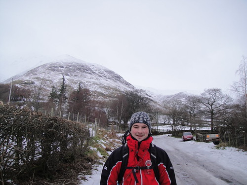
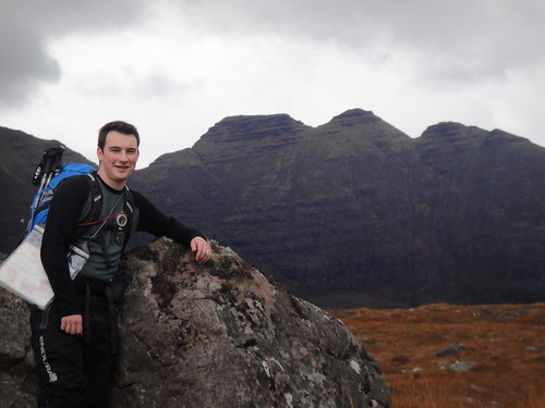
I arrived late on the Wednesday night and only Jamie was still up when I arrived at Ninebanks. After a brief bit of banter and a catch up, we headed to the bunks for a good nights rest. The next morning I met my group for the first time; a Gold Qualifying group of sixth year lads - a nice bunch. The weather that morning was rather dreich; perfect for some micro nav so we set out from the hostel over Mohope Moor. We spent the morning 'finding' various features in the landscape using the 1:50k map. The boys quickly discovered that fences and walls are not marked on these maps... and that there are a lot more of them about down here compared to Scotland! Usually in the D of E groups there is one pupil who is the navigator for the group, so I was keen to try and get them all up to speed and not just be relying on one person all the time. We also looked at pacing and different types of bearings and how to use them. After messing around, we met Jane and her group for lunch on top of Hard Rigg. After a bite to eat, we gave both groups the challenge of leading us all safely to Alston for some afternoon tea. A gentle first day.
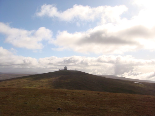
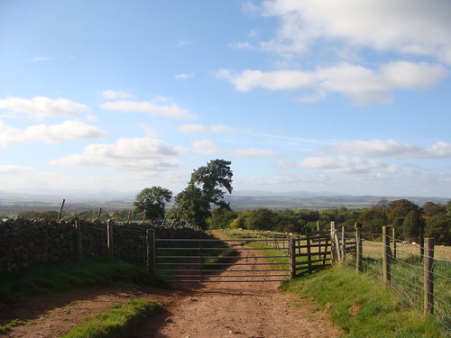
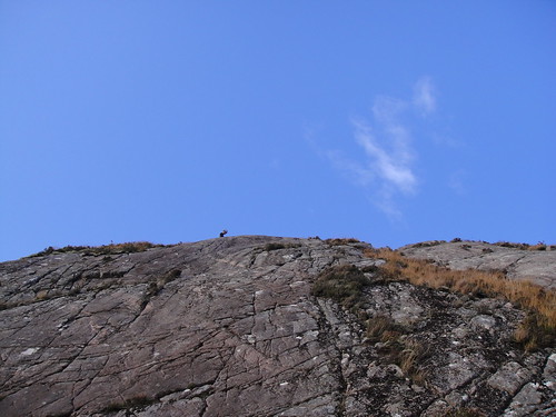
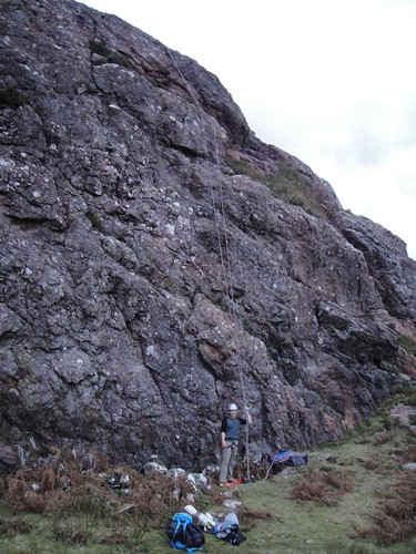
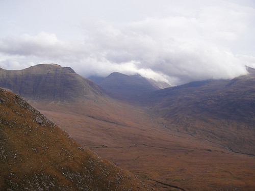
Looking South down the track towards Townhead, Pennines
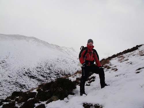
On Friday, the lads left around 9am and the mist was still down. They were heading to first but not across the moor this time. I took the opportunity to grab a cooked breakfast in Alston before seeing them through the village safely - their spirits seemed high, despite the drizzle. Once through Alston, their route took them South and then West, over the river to Leadgate. Here, they joined the A686 for a short time before turning off and heading South along the Maiden Way to Townhead (Camp 1). I saw them join the main road at Leadgate, and then I drove round to introduce myself to the farmer at Townhead. Once I had established which field the lads were to camp in, I dropped off the jerry cans and headed up Muska Hill. By now the mist had all burnt off and it was a glorious sunny day so after Muska, I headed over to the summit of Brown Hill to see if I could spot the lads coming towards me. However, as I gazed across Srony Rigg and along to Melmerby Fell, there was no trace of the group. A little puzzled, I pushed on to the summit of Melmerby to look right along the Maiden Way; but still nothing. Even more confused by now, I re-traced my steps back to the campsite and waited in the car for a while. Just as I was starting to get a little anxious, the lads appeared coming up the road in front of me: the complete opposite way to what they were meant to be doing. They looked shattered, but smiled broadly as they greeted me. After a quick chat, and helping them put up tents, it transpired that they had come down off the ridge too early and ended up in Melmerby - but they understood where they had gone wrong and found their way to camp without difficulty. Pleased by how they were performing and that they were now settled, I left them to it and headed back to Ninebanks for a late supper and a good sleep.
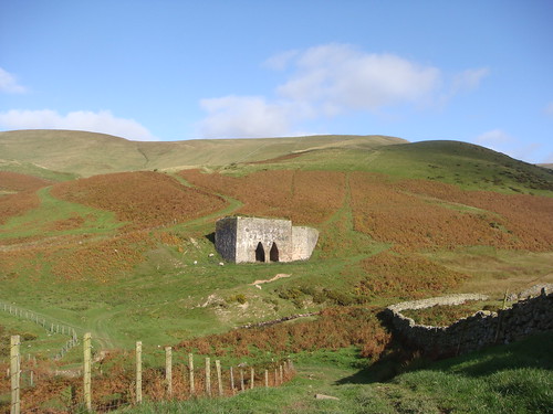
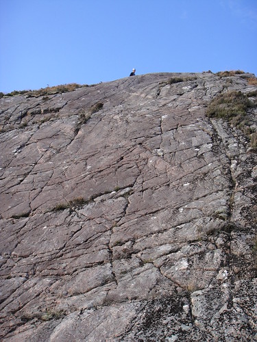
Looking up at Brown Hill from Townhead, Pennines
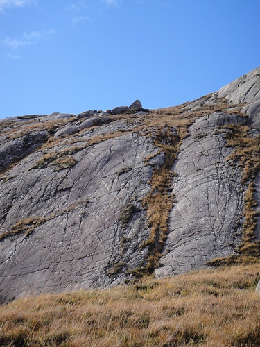
Nearing the top of Muska Hill, Pennines
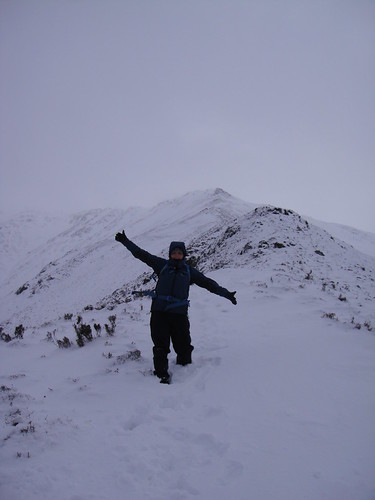
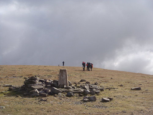
On Saturday morning I left swiftly after breakfast to check the campsite and to collect their rubbish - all was well and they had left me a route card to let me know that they had left on schedule. After the farmer had kindly let me fill the jerry cans, I headed up the road to Dufton (Camp 2). After introducing myself to the campsite warden, I drove up towards the radar station on Great Dun Fell. I parked the car at the side of the road, just behind Knock Pike, and set off along the side of the tarmac road. I found this road walking pretty tedious so I hopped over the barrier and contoured up through the gully above Knock Ore Gill - an interesting and very loose scramble! I passed swiftly around the edge of the radar station and joined the Pennine Way to Little Dun Fell and then on to Cross Fell. I was surprised to find a large, multi-sided drystone shelter on the summit, but made good use of it for my lunch stop as I waited for the lads to arrive. It was another fabulous day, with clear views South to The Dales - spectacular. It wasn't long before the lads arrived for lunch and by the look on their faces: didn't expect to see me up there waiting for them. A couple of them were covered in mud and they told me that they had encountered a rather large bog on the way up from Kirkland. I din't hang around long and I left them in good spirits to head back over the ridge to the car. When rounding Great Dun Fell for the second time, I spotted Jane coming around the other side. We walked on a little and had a natter, and then Jamie wandered casually around the corner, coming across the ridge from the other direction - what a coincidence! Jamie said he was heading back to his minibus and I said I would give Jane a lift back down to Dufton. When we arrived there, Tam's group were already at the campsite and all set up. Jane and I grabbed a quick coffee and a cake in the Pub across the road and watched for my lads coming into town. They were bang on schedule and after a quick 'hello' I left them to it and headed back to Ninebanks for the evening.
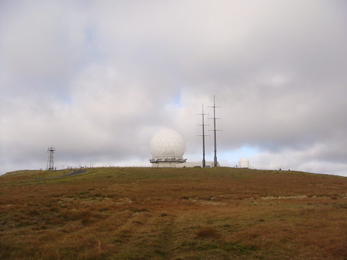
Radar Station on the summit of Great Dun Fell, Pennines
Great Dun Fell from Little Dun Fell, Pennines
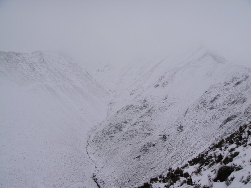
Sunday was a real dog of a day, but not surprising after a glorious two days of sun - it had to break sooner or later. The lads were following the Pennine Way for most of the day but I was a little concerned about them navigating their way through to Cauldron Snout in the thick mist. Tam said he would check the campsite for me in the morning, so I took another opportunity to grab a cooked breakfast in Alston. Afterwards, I went and introduced myself to the farmer at Dale Head (Camp 3) and dropped off a couple of jerry cans for the lads. I then headed down the road to Cow Green Reservoir and parked up at Cauldron Snout. Now it just so happened, that I had my mountain bike with me on the back of the car; and I was very glad I did. I had tremendous fun tearing along the track to Birkdale farm. But if anyone wants any advice for the next bit... be prepared for you lungs to burst! It was a steep and technical climb up a single track with rather large stones to negotiate. Once onto the open ground, there is a nice wooden walkway over the worst of the bog. However, this soon ends and the terrain becomes pure bog and is not cycle-able. I accepted defeat at this point and waited here, hoping that the lads would appear out of the thick fog at some point - I could just about see my hand in front of my face! I had only been resting there for a couple of minutes when I heard singing coming from somewhere in the mist; it was the lads! I was quite pleased to see them and I could tell that they definitely did not expect to come across me there in the mist, much to my delight. They were in good spirits but clearly finding the conditions hard, but they were pleased to now be on the home stretch. I left them and cycled off into the mist ahead of them and back to the car to get warm and to dry off - unfortunately the lads had no such luxury. I grabbed a quick coffee at Langdon Beck before seeing the boys into their final camp and then headed back to Ninebanks.
The lads leaving the summit of Cross Fell, Pennines
On The Screes of Cross Fell, Pennines
Monday was the final day and all the groups, including mine, were to finish in Alston in the afternoon. We all went for an assessors breakfast in Alston before going our separate ways to check on our respective groups. There was no trace of the lads at their final campsite; only their bag of rubbish and the empty jerry cans. I headed back towards Garrigill, hoping to spot them from the road - but visibility was poor and I saw no sign of them. At Garrigill I bumped into Alan waiting in his car for his group to pass through. He then told me rather casually that the lads had pasted through 'ages ago' and I thought that they should be finished by now. A bit gutted to have missed them, I headed back to Alston. I found them all in the cafe happily munching on all-day breakfasts. Once fed and watered, we had a bit of a debrief about how everything went. It turns out that they had decided to get up really early and just get the last few km over and done with. I didn't have a problem with this, it was just a bit of a shame that I wasn't waiting for them at the finish to congratulate them properly. Despite this, I was very impressed with them as a group and I told them this. Sometimes I DO get the good groups after all...
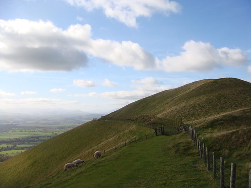
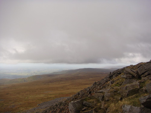
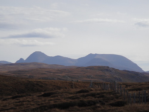
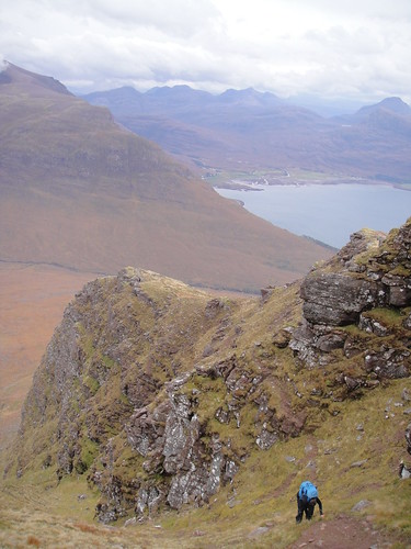
Looking South towards The Dales from Brown Hill, Pennines
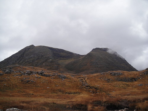
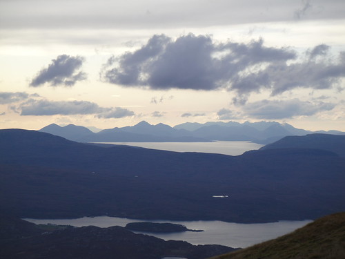
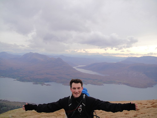
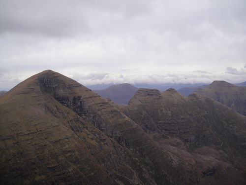
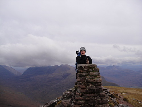
All of the other groups finished safely without any drama so all they could do was sit around and wait for the coach to arrive and take everyone back to Edinburgh. I headed home buzzing after a very enjoyable few days in the Pennines and I couldn't wait to go back - what a place! On the drive home, my thoughts turned to Torridon: where Emily and I are heading tomorrow!